Showing posts with label Hamilton Burlington Trails Council. Show all posts

Monday, July 20, 2015

Ontario Trail News - Ontario Trail Counts and Hamilton Trail Survey

Learn more about your trails - Trail Counts


Trail Counts
Ever wondered who is using your trail and when? Looking for more than just a static count of trail activity? Tell others about what type of person is using your trail, what makes your trail a popular destination...and more!

We have your answer.

Utilizing smartphone technology trail users can now complete a short survey that:
Logs in the trip
Single counts individual users
Consolidates results for centralized reporting
Consultation on survey content.
We ask your questions - the facility manager asks what they want to know!
Allows for separate trail counting
Multi-season operation
24/7collection
Identifies quality of trail experiences
Provides you feedback loop
____________________________________


Year-long trail survey tracks walks in the park

Hamilton Spectator
Joggers, bikers and even parents pushing baby strollers shouldn't be surprised if someone with a clipboard asks them why they're using Hamilton nature trails.
Throughout the next year, impromptu questionnaires are one of the ways the Hamilton Burlington Trails Council (HBTC) and McMaster University are completing one of the most extensive trail surveys ever conducted in Ontario.
The joint initiative launched on Thursday will use online surveys and up to 36 volunteers to survey trail users on the flyto find out who's walking the trails, how they get around and where and why they're choosing the paths they are on.
The goal is to find out if certain paths could be linked, what trails are most popular and which need attention. In Hamilton, there are more than 130 kilometres of nature trails.
"The City of Hamilton has a lot of trail head counts, but we don't know who they are. Are they on bikes? Are they walking with dogs? Do they live nearby? Do they come here often?" said Wayne Terryberry, HBTC chair and McMaster University Outdoor Recreation co-ordinator.
"What can we use to make the trail experience better? We want to get definite data in different seasons — an annual time table."
The data along with information from community partners like Hamilton Conservation Authority and the Royal Botanical Gardens will go toward building a comprehensive trail map.
"We have 13 survey locations through Hamilton and Burlington and they are going to be surveyed by volunteers, and at each survey there will be a manual head count of people passing by," survey co-ordinator Alex Farquharson said.
Matthew Brodka of McMaster University Outdoor Recreation said one of the challenges facing the study is weather.
"Especially if it's a year-long thing, but we have a passionate group of volunteers who are passionate about the trail system."
Ward 1 Coun. Aidan Johnson said the survey data can have a broader impact on people.
"The more people who use and see nature, the more people who'll want more effective environmental policies and more biodiversity protection," he said.
People interested in helping as volunteers for the project throughout the year are encouraged to visit the Hamilton Burlington Trail website, http://hamiltonburlingtontrails.ca/.
905-526-3434

Saturday, December 27, 2014

Ontario Trails News - explore the Halton ECO-Park, it's got trails

Learn more about accessible trails, and how to promote them to all Ontarians

Dec 25, 2014 | Vote0   0

EcoPark's natural beauty only a hike away

Burlington Post
Smokey Hollow is one of my favourite hiking spots.
I came across it years ago in a book of maps of hiking trails in southern Ontario. It was a dot on a piece of paper on Mill Street just north of the Burlington border.
It turned out to be much more than just a dot.
The waterfall is arguably the premier attraction; Grindstone Creek cascades down a dramatic drop.
Once you descend several flights of natural and man-made stairs, the noise of traffic disappears and tranquility dominates.
It was here that I saw my first and only wild trillium to date.
Coincidentally, Smokey Hollow was one of the first spots the Burlington Post team consisting of photographer Eric Riehl and myself recently visited on a walking tour for our feature on the Cootes to Escarpment EcoPark System.
The walking tour idea was mine — any chance to trade in high heels for Sorel boots is welcome.
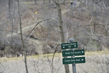
David Galbraith, longtime head of science at the Royal Botanical Garden, and John Hall, co-ordinator with the Hamilton Harbour Remedial Action Plan, served as our guides, taking us to stunning sites like the Grindstone Estuary marshlands, Kerncliff Park, Clappison Woods and Smokey Hollow.
As a nature lover, I had been to all these sites before, but the historical background and ecological significance shared by David and John elevated my understanding of why protecting these lands through the Cootes to Escarpment EcoPark System initiative is so important.
Smokey Hollow is an example of how an area can recover after human impact.
In the 19th century, Grindstone Creek was the site of industrial mills, which are now gone. The site has potential for further naturalization, as well as trail enhancements. The trail is particularly rich with wildflower species.
The Cootes to Escarpment EcoPark System, formally established in 2013, is a partnership between nine partner agencies. It encompasses approximately 9,000 acres of natural lands at the western end of Lake Ontario. Of that number, 4,700 acres are permanently protected while 4,300 acres are privately owned. Included in the 1,500 documented species of flora and fauna is more than 60 species at risk, including the endangered Jefferson salamander.
I encourage everyone to read my feature on the Cootes to Escarpment EcoPark System at http://bit.ly/1z1h4Woand experience these precious lands.