Thursday, June 25, 2015

Ontario Trails - Putting Hamilton's trail system in the spotlight


Putting Hamilton's trail system in the spotlight

Surveyors looking to build interactive map, improve amenities

By Tucker Wilson, CBC News Posted: Jul 02, 2015 5:50 PM ET Last Updated: Jul 02, 2015 5:50 PM ET
Signage is just one of the many aspects the trail survey will look at.
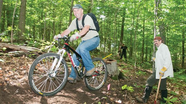
Signage is just one of the many aspects the trail survey will look at. (CBC)
A yearlong trail survey is being launched next Thursday in an effort to get a more whole understanding of Hamilton and Burlington's trail systems and who uses them.
The Hamilton Burlington Trails Council and McMaster University are heading the project, which will be one of the most extensive trail surveys ever conducted in Ontario, a press release said.
"We already know that trails play a role in improving well-being and quality of life in communities," said survey coordinator Alex Farquharson. 
"Really, what we are trying to establish is how our trail network can be improved to better meet the needs of our population."
The survey aims to establish such things as: 
  • Who is using the trails?
  • What modes of transportation are being used on the trails or to get to the trails?
  • Where would a trail link be most beneficial?
  • Why are community members choosing to use trails?
Surveys will look specifically at putting together a whole interactive online map of the trails in the two cities, said Wayne Terryberry, HBTC chairperson and McMaster outdoor recreation coordinator.
"We're always finding we need to have more trail user information," he said.
Aside from information, Terryberry said the most important upgrade the trails require is accessibility and amenities like benches and washrooms for an aging population.
The survey groups are looking at other internationally recognized trails – Appalachian, Indianapolis, and Spain – as models for Hamilton and Burlington's paths.
But they're going to need input from locally surveyed trail-walkers, either online or in person, which is going to require volunteers.
Terryberry said the HBTC has between 12 and 15 volunteers for the summer, but they'll be looking for more now and over the course of the year.
"And we're asking those on the trails to take a few minutes out of their day to answer some questions," he said, adding that there was an online option for the impatient trailblazers.
The HBTC and McMaster will be holding an event on July 9th at 9:30 for the survey's launch. Terryberry will be in attendance along with Hamilton Coun. Aidan Johnson and Chris Firth-Eagland of the Hamilton Conservation Authority.
"We're so lucky. We've already got an incredibly scenic view on our trails," said Terryberry. "Now we just want to make sure we have an incredible trail experience."

Wednesday, June 24, 2015

Ontario Trails - Durham Mountain Biking Association getting ready to unveil 12 kilometres of new trails


Mountain bikers hard at work on new Uxbridge trail network

Durham Mountain Biking Association getting ready to unveil 12 kilometres of new trails

SIDEBAR

HOW THIS IMPACTS YOU
• More trails mean more recreational opportunities for all Durham residents.
• The project was designed to fit into and enhance Uxbridge’s designation as the Trail Capital of Canada by attracting riders to the area from surrounding communities in York, Toronto and Northumberland.
• Mountain bike specific trails should help to reduce bike traffic on other trail systems and reduce user conflict.
Uxbridge Times Journal
UXBRIDGE -- A new trail system for area mountain bikers is slowly but surely emerging out of the forest surrounding Dagmar Ski Resort’s cross-country trails.
The massive Dagmar North Trail Project, which has been undertaken entirely by volunteers from the Durham Mountain Biking Association, will include 12 kilometres of new single-track trails built and designed by mountain bikers for mountain bikers, although they will be open to all users once completed. The build was made possible by a partnership with the Toronto and Region Conservation Authority, which owns the land, and a $20,000 grant from the National Trails Council, which the DMBA matched.
“The TRCA is very much a partner and one thing they see is that this will reduce pressure on other TRCA lands,” said Tom Hanrahan, president of the DMBA, noting the nearby Durham Forest is currently one of the most heavily used trail networks for bikers.
“By creating more mountain bike-preferred trails we can reduce conflict between users and create some cool features too. Also Uxbridge is the Trail Capital of Canada so this is a great fit because it really enhances that.”
Nearly 150 volunteers have so far contributed more than 2,000 hours to the project, which will connect with Durham Forest and Glen Major Forest to create a loop. John Fisher, project lead for the DMBA, estimates that it takes about 350 volunteer hours to make one kilometre of trail. Currently six of the planned 12 kilometres have been completed.
“We’ve been on site working since April, but that doesn’t include the last six years of planning,” he explained, noting the DMBA has been negotiating, applying for grants and planning out trails for the project for far longer.
To create a trail, planners start with topographic maps, from which they choose potential corridors. The DMBA builds on slide slopes to prevent erosion and increase sustainability as it allows water to run off the trails rather than pooling and leaving behind mud.
“Once we do the topographic maps, we come out and walk and walk and walk,” Mr. Fisher explains. “We spend hundreds of hours just walking.”
That includes walking the chosen corridor and fanning out 50 metres to either side in search of natural features that can be incorporated into the trails, such as aggregate holes or drop-offs.
The only hired contractors are the machine operators who come in to create a loose corridor out of the brush, which volunteers then proceed to clear and shape, adding features and removing any hazards.
“This was a huge project, we really had to sell it to the club, but we thought it was important,” Mr. Fisher explained. “Now that it’s underway the people working on it are really excited and it’s created a lot of buzz in the community.”
Volunteers Genevieve Damphousse and Brian Bartlett joined the group on June 23 for a build night at the forest. They said building has allowed them to take ownership of the trails they will soon be enjoying.
“I think when you ride the trails knowing you built them, it’s more adrenaline,” Mr. Bartlett said. “It’s another perspective from what you get when you’re riding, building is much more technical with the angles and making the water drain, it’s interesting to see what goes into it.”
“We really like mountain biking and this is a good way to know the trails and just be a part of the project,” Ms. Damphousse added.
While DMBA has some history building trails, having added between seven and 10 kilometres of trails to the area in the last few years, this is the first time they have created specific mountain bike-preferred trails compared to multi-use.
“One reason we wanted mountain-bike specific trails was so we could relieve some bike traffic on other trails,” Mr. Fisher said, noting the trails will still be open to all users. “The mountain bikers build trails for everybody and we really try to educate our members on trail etiquette to reduce any user conflict. Bikes give way to everybody, that’s the rule.”
The association expects to have the trails completed, signed and ready for users in September.
“As much as we like building trails, we much prefer riding the trails,” Mr. Hanrahan said excitedly. “This is the biggest project we’ve ever taken on so it will be nice to see it when it’s done.”
DMBA is currently fundraising to recoup the $20,000 put into the project. Visit www.durhammountainbiking.ca to donate or for more information.

Tuesday, June 23, 2015

Ontario Trails - Canada AM visits Manitoulin as guests of Circle Trail


MANITOULIN— CTV’s Canada AM is probably the nation’s most popular morning newsmagazine program and last month the Great Spirit Circle Trail (GSCT) played host to a hardy team of tourism adventurers who came calling to explore the home of the Great Manitou.
“They called us,” said GSCT Tour Developer Bonita Taibossigai, who noted that the GSCT often gets calls from the Ontario Tourism Marketing Partnership (OTMP).
The team pulled into the Manitoulin Hotel and Conference Centre one Friday night after travelling on the Chi-Cheemaun ferry and consisted of travel blogger and Canada AM contributing editor Loren Christie, Canada AM producer Katie Jamieson and veteran cameraman Craig Sansom.
“I was on my way back from a conference, travelling with Helen Lovekin (media relations coordinator at OMTP) talking about tourism in Northern Ontario and she insisted ‘you have to visit Manitoulin Island’,” recalled Mr. Christie. “So here we are.”
Mr. Christie is described on the Canada AM website as “a fervent traveller who has visited more than 55 countries around the world. He has appeared on numerous television and radio programs over the last eight years and especially enjoys promoting the joys and pitfalls of travel to Canada AM’s viewers across Canada, as the show’s resident travel expert.”
“The trip across on the ferry was quick and great,” said Mr. Christie.
Cameraman Sansom, who hails originally from London, England, was particularly taken by the sense of peace and tranquility that emanated from the shores as the team arrived. A far cry from the hurly burly bustle of Toronto, where the team had set out from.
Mr. Christie’s enthusiasm for new experiences was evident from the start and he said that he was excited by the list of sights and sounds the team would be investigating over the next two days.
Dinner at the Anchor Inn restaurant and a self-guided tour of the Little Current set the tone for the beginning of the visit.
Under the wing of GSCT guide Steve Antoine, the team took part in an early morning canoe tour of Lake Mindemoya before taking in lunch at Maggie’s in M’Chigeeng, then it was off to take part in one of the GSCT’s signature experiences, bannock and berries.
“Loren’s bannock turned out perfect,” said Ms. Taibossogai.
Then it was a jaunt to Bridal Veil Falls and a tour of the picturesque village of Kagawong before dinner at Season’s Restaurant in M’Chigeeng.
That evening saw another signature event, the Seven Drum Make and Take. “They just made one drum,” said Mr. Taibossogai. “But they seemed to be having a lot of fun.”
The next morning it was Sunday brunch at Abby’s Crosshill restaurant before the team made its way back to South Baymouth and the return to southern Ontario.
The Manitoulin Island episode should be airing “sometime in July,” said Ms. Taibossogai. “They will call to let us know when it is supposed to go to air.”
In the meantime, Mr. Christie’s travel blog can be found online at the Canada Am website.
- See more at: http://www.manitoulin.ca/2015/06/30/canada-am-visits-manitoulin-as-guests-of-circle-trail/#sthash.CQ71LJ1Q.dpuf

Monday, June 22, 2015

Ontario Trails - Biking a New Route Through Ontario's Scenic Greenbelt


CreditFriends of the Greenbelt Foundation
Greenbelt Biking A new Canadian bicycle route will take riders through 295 miles of Ontario’s Greenbelt (above), an area encompassing about two million acres of protected farmland, green space and natural heritage sites. The Greenbelt Route uses existing roads and trails, starting in Queenston near Niagara Falls, following the curve of Lake Ontario and ending in Alderville First Nation.
A downloadable map details the route and also includes day-trip itineraries.
The trail officially opens on Aug. 16 with the start of the six-day Greenbelt Route Edition of the annual Great Waterfront Trail Adventure.The full bike tour, sponsored by the Waterfront Regeneration Trust, costs 866.37 Canadian dollars (about $704 at 1.23 Canadian dollars to the U.S. dollar), with some youth discounts available, and a three-day option is 470.87 Canadian dollars.

Friday, June 19, 2015

Ontario Trails - Great Waterfront Trail Adventure heads north to Uxbridge


Great Waterfront Trail Adventure heads north to Uxbridge

Annual ride ditches waterfront in favour of new Greenbelt Route

Uxbridge Times Journal
UXBRIDGE -- A new cycling event is coming to the trails of Uxbridge as the annual Great Waterfront Trail Adventure moves north, and off the Waterfront Trail.
The six-day ride, which runs from Aug. 16 through the 21, will be traveling along Ontario’s new Greenbelt Route, which spans seven regions from Niagara to Northumberland, including Uxbridge.
“Just as the Waterfront Trail has done, the Greenbelt Route will help boost Ontario’s reputation as a premier cycling destination,” said Marlaine Koehler, executive director of the Waterfront Regeneration Trust, which organizes the ride.
“The new route will help serve the growing cycle tourism industry in Ontario, which brings in millions of dollars every year, and give locals and tourists access to attractions, natural landmarks and conservation areas.”
The trail enters Durham in Uxbridge along the Uxbridge-Pickering Townline before heading north up to Brookdale Road, then back down into Whitby and across Myrtle Road through Oshawa and Clarington into Northumberland.
Riders along the route will have a chance to explore the communities they travel through, shopping and enjoying local cuisine.
“Spaces are filling up fast for the ride,” Ms. Koehler said. “Each year, cyclists come from all over the country and beyond to ride with us. We always sell out quickly so I would urge people to sign up now to avoid disappointment.”
The Greenbelt Route is the result of a three-year initiative by the Friends of the Greenbelt Foundation and the Waterfront Regeneration Trust, in collaboration with the 27 communities along the route.
This year the Waterfront Trail Adventure will begin in Roseneath and finish in Niagara, with overnight stays in Port Hope, Uxbridge, King Township, Halton Hills and Hamilton.
“This adventure will increase appreciation for the world’s largest Greenbelt,” said Burkhard Mausberg, CEO of the Friends of the Greenbelt Foundation. “Come be the first to experience the plentiful forests, rivers, welcoming towns, and family farms along this exciting cycle tourism attraction.”
If six days seems like a bit too much for some riders, participants also have the option of signing up for the three-day Taste of the Greenbelt Tour.

Thursday, June 18, 2015

Ontario Trails - Big boost for Eastern Ontario Trails Alliance


Big boost for Eastern Ontario Trails Alliance

Central Hastings News
By Brett Mann 
Tweed - On a June Friday that saw another major  federal funding commitment to the Trent-Severn Waterway system, MP Daryl Kramp announced $610,000 in support of the Eastern Ontario Trails Alliance (EOTA).  At an EOTA meeting in Tweed council chambers, Mr. Kramp reported that in the 2014 to 2016 time period, the federal government has committed $10 million across Canada for the National Trails Program.
 “Today's announcement is actually an additional funding, locally and regionally through the Eastern Ontario Trails Alliance, through the EODP (Eastern Ontario Development Program), a combination of funding directly through the National Trails Program and our local Community Futures and I cannot say enough about our local CFDCs,” said Mr. Kramp in his brief address. Of the announced $610,000 funding, $270,000 comes from the National Trails Program and $340,000 flows from the federal Eastern Ontario Development Program through the Frontenac and North Hastings Community Futures Development Corporations.
 An accompanying press release notes that the funding will improve trail infrastructure, encourage job creation, link communities and increase recreational opportunities. Quoting Jo-Anne Farquhar, President of the National Trails Coalition Board, the press release states “... trail user groups can now apply for project funding to facilitate trail building, refurbishment and upgrade activities that will be beneficial to the long term sustainability of all forms of trail-based activities across Canada.”
David Gerow, Chair of EOTA told the group, “Our organization is extremely happy and thrilled to be receiving this amount of funding from the federal government to match the dollars that have been raised through our local municipalities and governments ... now that we have some new regs from the MTO for ATVs, side-by-sides and so on, that they're going to be able to get on the trails, it's going to be another boost to our economics.”  EOTA trails range from Algonquin Park to the Bay of Quinte. The Alliance estimates the trails draw 25,000 users and bring in $6 million to the economy annually.
 “You folks have been very, very aggressive in stepping up to the plate to not only ensure you get a share of that money but to use it exceptionally well. I've seen it on so many occasions,” said Mr. Kramp noting that he travels the trails himself, and for years was involved with snowmobiling, cross country skiing and four wheeling. The one trail use he has not tried is horse riding. “Horses and I don't see eye-to-eye,” said Kramp to chuckles from the assembled crowd.
 Kramp praised “local people making local decisions. People that know what they're talking about.” Hastings County Warden Rick Phillips commented that the county has been a great supporter of the trail system and that he sees no reason why this will not continue.

Wednesday, June 17, 2015

Ontario Trails - Ontario Place trail named after former premier


CTV Toronto: Revitalizing Ontario Place
Gated off and waiting for a makeover, the first steps are now being taken to revitalize Ontario Place. Natalie Johnson reports.
41
6
47
  • 0

CTV Toronto
Published Wednesday, June 24, 2015 8:22PM EDT 
Plans for Toronto's revitalized Ontario Place will include a new waterfront trail named after the province's former premier Bill Davis.
Davis -- who was premier when Ontario Place opened in 1971 -- was joined by Premier Kathleen Wynne for a ceremony at the park on Wednesday, when plans for the new William G. Davis Trail were announced.
"This is once again going to be a place that’s accessible to all of the people of the province and the country," Wynne told reporters.
Wynne also announced that an existing parking lot will be transformed into a 7.5-acre urban greenspace. It's expected the first phase of the revitalization effort will be complete by fall 2016.
Ontario's Minister of Tourism, Michael Coteau, says he hopes future phases of the project will begin taking shape in the next two years.
That vision includes a new waterpark, a common space for festivals and events, an expanded live-music venue, and a waterfront promenade lined with stores and restaurants.
The former jewel of the waterfront was closed in 2012.
With a report from CTV Toronto's Natalie Johnson