Showing posts with label Sentier Prescott Russell. Show all posts

Thursday, December 8, 2016

Ontario Trails News - Membership renewals welcomed! Trailhead Canada and an important day "Let's Talk Trails" in Landsdowne Ontario with FABR!

Let’s Talk Trails – December 8, Glen House Resort

 
Over 60 people attended the Let's Talk Trails forum funded in part by OTC through the Trails Tourism Integration Project.

Ontario Trals provided a program overview and provincial level update. We connected with RTO9 staff, DMO staff and DMP staff in order to integrate content on the OTC website.


Don Ross and Hilary Hone from FABR staff opening the day.


OTC works with the Biosphere to promote all types of trails, including infrastructure, trails crew employment, training and specialty infrastructures.


Emily Conger speaks about the Algonquin to Adirondack trails and the desire to support this significant international trail product in the region.

Information was shared on:
  • Maps, mapping for use, and linear maps
  • Product readiness surveys
  • Use counts
  • Species at Risk
  • Balancing trails use and separating pout trails users by having products available
  • Maintenance issues, grants suppliers, groups purchasing, all the trail networks
  • Trail blazer program
  • Through OTC get one company who builds websites, one co to handle the booking and branding it, build the website with standardized websites, crowd sourcing the information.
  • Revitalization of Frontenac Arch Biosphere Reserve as the Regional Trails Council
  • Discussion of the need for risk management program and training
  • Minimum maintenance standard for sidewalks, get it applied to trails as a provincial standard.
We wish to thank FABR and all the participants for their input and contributions.

 
Trailhead Hastings Announced


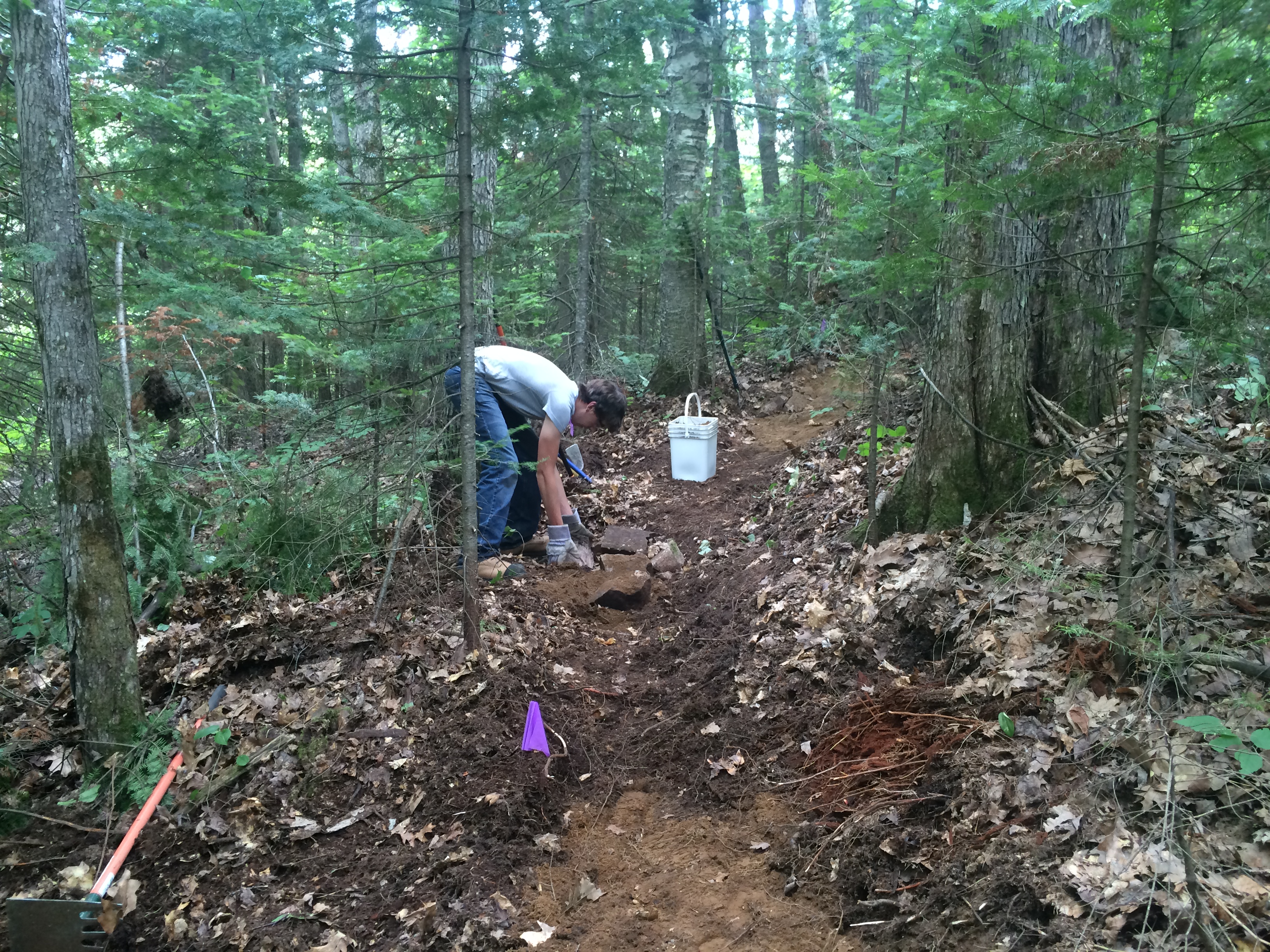
HASTINGS COUNTY TRAIL PHOTOS
 

Trailhead Toronto - Nov. 24th, Session Presentations Available On-Line!
A BIG thank-you to all the people who so graciously contributed their time and expertise to make a contribution through presentation at Trailhead Toronto!
Ministry of Tourism Culture and Sport announces Community Recreation Funding

Ontario is now accepting applications for the Ontario Sport and Recreation Communities Fund (OSRCF) 2017–18.
OSRCF is a grant program that supports the government’s vision to enable people in communities across Ontario to lead healthy, active lives. The fund increases opportunities for participation in sport and recreation, supports implementation of physical literacy as a foundation for lifelong physical activity and strengthens the community sport and recreation sector.

The deadline to apply for the Ontario Sport and Recreation Communities Fund 2017–18 is February 1, 2017 at 5:00 p.m. EST.

Full details, including who’s eligible and how to apply, are available through Grants Ontario, the government’s one-window access to information about grants.

To contact the ministry, please email OSRCF@Ontario.ca

Please feel free to share this notice with your members or other sport and recreation partners and providers in your area.
_______________________________________________________________
L’Ontario accepte maintenant les demandes au Fonds ontarien d’action communautaire pour les sports et les loisirs (FOACSL) pour 2017-18.

Le FOACSL est un programme de subventions qui appuie la vision du gouvernement permettant aux gens dans des communautés partout en Ontario de mener une vie saine et active. Le Fonds augmente les possibilités de participation à des sports et des loisirs, soutient la mise en œuvre du savoir-faire physique comme fondement de l’activité physique et renforce le secteur du sport et des loisirs communautaires.

La date limite pour présenter une demande au Fonds ontarien d’action communautaire pour les sports et les loisirs pour 2017-18 est le 1er février 2017 à 17 h HNE.

Des informations complètes, y compris sur l’admissibilité et comment présenter une demande, sont disponibles à Subventions Ontario, un guichet unique d’accès à l’information gouvernementale sur les subventions.

Pour contacter le ministère, veuillez envoyer un courriel à l’adresse OSRCF@Ontario.ca.

N’hésitez pas à partager cet annonce avec vos membres ou autres partenaires et prestataires en sport et loisirs de votre région.
 

239 People want the Prescott-Russell Rail Trail saved!
SIGN OUR PETITION TO SAVE THE TRAIL! COUNCIL MET AND CUT THE BUDGET
prescott-russell trails petition
UPDATES:
OTC visited Prescott Russell and met with Council and the Economic Development Committee. There may be operating budget cuts in the near future but there is a desire to save the trail, although it may not be 72 continuous kilometers. Road links are being studied between nodes. While this is not preferred, we are pleased that the Prescott-Russell Economic Development Committee spoke with OTC and that we are working with the County to:
  • diversify the role of the Prescott Russell Trails Committee,
  • seeking funds,
  • engaging inter-provincial partners,
  • that the Trail is highlighted as part of the CycleON list of trails through consultation
  • had more counters to install
  • is implementing the OTC Trail Counts Program
  • OTC has found the trails committee, through partnership, free fundraising training in Ottawa
We encourage the people signing the petition to work with UCPR and OTC to find ways to re-negotiate the lease with Via so we can make the corridor multi-use, which would enable cost recovery, new funding for capital projects and engage more members of the community to utilize the trail in the future.

If you want to help please contact Louise Bissonette with Sentiers Prescott Russell! Merci.

 
LocationDate
Niagara Region RTO2December 14th
Landsdowne RTO9December 8th
Collingwood RTO7TBA

 During each session we will discuss:
  • Current RTO+DMO Tourism Strategies
  • Current Outdoor Activity Marketing
  • Existing Trail Inventory
  • Identify Gaps
  • Consolidate Events
  • Review Ontariotrails.ca Trails Marketing
  • New Content Initiatives
  • Share Data and Data Gathering Processes
  • Review TTIP Action Plan Outlines
  • Define Next Steps
For more information contact Patrick Connor at 613-484-1140
Locations to be announced.
Cycling Consultations Completed

ontario trails ontario cycling consultations
Dear Stakeholders,

Thank you very much again for your interest and participation in the study to help identify Ontario’s Province-wide Cycling Network. We hope that the regional workshop session you attended was informative; providing you with:
  • Background information on the study;
  • Context on the intended outcomes;
  • An overview of the process being used to identify the network; and
  • An opportunity to be engaged in the study process.
As noted at the regional workshops, we would encourage those of you who were able to attend to continue to review and provide comments on the materials presented. We would also encourage you to reach out to any of your partners that did not have a chance to attend the session to share the information provided and provide questions / comments to the study team.

The study team has consolidated the materials presented at the workshop sessions and uploaded them to DropBox. They can be accessed using the following link:
MTO Cycling Network Study Dropbox
*Please click on the proceed without signing up option at the bottom of the page if you do not already have an account

We have uploaded network concept mapping (route options and alternatives that could form part of the province-wide cycling network (priority routes) or link up to the province-wide cycling network (secondary routes)) for each of the MTO Regions. We are in the process of uploading maps illustrating the network concept in zoom in areas of the Upper Tier Municipalities. The zoom in maps will be uploaded to the site by first thing tomorrow morning. Please select the mapping that is most appropriate for your jurisdiction. We would also encourage you to review the workshop presentation. The presentation will give you the necessary context to better understand the information that we are asking you to review and comment on.

We will be accepting comments / questions / submissions to the regional workshop materials up until December 8th, 2016. More specifically, we are looking for the following comments to these maps:
  1. Route Alignment: focusing on the priority and secondary routes, provide comments on the location of the potential routes, whether what is being identified makes sense or if there are other alternatives that should be considered.
  2. Potential Level of Separation for Facility types: identification of a potential level of separation for a cycling facility type based on the hierarchy of options identified in Ontario Traffic Manual Book 18:
    1. Shared Facilities: On roads with low operating speed and low traffic volumes where the cyclists and motorist share the same space e.g. signed bicycle routes
    2. Designated Facilities: on roads with sufficient space and a higher operating speed and traffic volume where cyclists require a specific space to ride e.g. bike lanes
    3. Separated Facilities: on roads with a high operating speed and traffic volume where a physical separation is needed between the cyclists and motorist e.g. off-road trail or buffered bicycle lane or paved shoulder
  3. Destinations: cycling destination such as bicycle friendly businesses or tourism attractors
  4. Barriers: physical barriers which prevent or deter implementation of cycling facilities or the activity of cycling
If you have any questions about the information that we are seeking or the study to inform your commentary please do not hesitate to contact mtocyclingnetwork@mmm.ca.

We look forward to receiving your input and continuing the discussion and identification of the province-wide cycling network for Ontario.

Best,
#CycleON - MTO Province-wide Cycling Network Identification Study
On behalf of the Study Team
-----------------------------------------------------------------------------------------
T: 905-882-7306
E: mtocyclingnetwork@mmm.ca

Thursday, October 6, 2016

Ontario Trails News - save Eastern Ontario's Prescott Russell Trail, Rotary Eco-Trail, STATO Trail and more Ontario Trails activity information and news!


ADD YOUR TRAIL

Ontario Trails - We Keep Adding Trails!!
On a regular basis the trail community sends us more trails to add to our website! Add yours today.


Sir John A. MacDonald Winter Trailsir john a macdonald winter trail

Photo Credit - Dave Adams pauses for a photo as he grooms the new Sir John A. Macdonald Winter Trail alongside the Sir John A. Macdonald Parkway Friday, Feb. 26, 2016. (Giacomo Panico/CBC)

A new trail for skiers, snowshoers and more is opening along the Ottawa River today.
The Sir John A. Macdonald Winter Trail runs along the Sir John A. Macdonald Parkway from the Canadian War Museum to Westboro Beach.
Sir John A Macdonald Winter Trail Map
The new Sir John A. Macdonald Winter Trail is running as a pilot project from the Canadian War Museum to Westboro Beach. (Westboro Beach Community Association)

It's a partnership between the Westboro Beach Community Association and the National Capital Commission, with help from Kitchissippi councillor Jeff Leiper and Dave Adams of the Nakkertok Ski Club.

"Growing up, Gatineau Park was really the only real ski area to be had but if I could get this inner-city facility up and running, everybody gets a chance to get cross-country skis on or [use] some other mode of transportation," said Adams, the ski club's trails and facilities co-ordinator.

Separate tracks

Adams told In Town and Out host Giacomo Panico on Friday the trail has one track groomed for skiing and a second for snowshoers, snow bikers and walkers.

"[This means] accessibility to the river in the winter months," he said.

"This is a time where the river is not well-utilized, there's not a lot of people out there and I hope this winter trail gets people out there."

More>>>>>>>>>


STATO Trail

stato trail ontario trails
Construction of the waterfront linear park expansion is recognized as part of the City of Temiskaming Shores' economic development goal of positioning the municipality as a retirement living community and tourist center.  The municipality views the STATO group as being a valuable catalyst to encourage "new tourism" dollars to our community.  The construction of the linear park expansion will not only provide leisure opportunities for the inhabitants and visitors to the community, it is also regarded as a determinant of public health.  

Health promoters recognize increased physical activity by all age groups as a factor of lowering incidences of chronic disease.  This park will become a destination for tourists looking for a healthy alternative to get-a-ways in the urban centres.

STATO has been and continues to be active lobbying local interest in the project and fundraising.  To date we have raised over $15,000 in membership only (new & renewal).  The cost of a membership of $10 per person.  The $10 membership is a great way for you (the community) to show your support towards our project. It is also a great way of fundraising. Furthermore, it is a big proof of community support when added on our funding application.  Community Support is a very important criteria.

STATO has also held many fundraising events, including an annual dinner/fashion show, annual amazing race, a walk-run-bike event, annual fishing derby, a sausage drive, a pond hockey tournament, a membership drive, annual chilly lunch, a chilly run, annual golf tournament, a human auction, a diva show, some walking and family biking events, and several other, raising over $372,000 locally thus far.  The momentum is building in the community for the development of the waterfront linear park, as part of STATO's active transportation plan. 

The benefits of constructing and maintaining the Temiskaming Shores Waterfront Linear Park Expansion will include, but are not limited to the following attributes.  The project will link many of the regional attractions that we have been building on in the past few years.  

For example, there will be a corridor of park land from the northern part of the Township of Dymond to the southern tip of Haileybury with a vision to link to Cobalt, along the shore of Lake Temiskaming along Dawson Point Road and into the Province of Quebec.  

Planning into the future could ultimately mean a natural waterfront expansion that circles Lake Temiskaming in its entirety.  Tourist attractions and retail businesses along the waterfront will be linked not only by highway/roadway but also by a walkway parkland area. the steps that have been taken by STATO to get where we are today.

http://www.ontariotrails.on.ca/trails/view/stato
 

Rotary Eco-Trail - O'Neill's Nature Preserveo'neill's nature preserve ontario trails
This granular surface trail forms an 880 metre loop through the O’Neill Nature Preserve, a large standing woodlot on the outskirts of Chatham.

The trail was built as a result of collaboration between a number of local organizations and individuals, including the Rotary Club of Chatham, Carolinian Canada Coalition, the Municipality of Chatham-Kent, and nearby residents.

An interpretative trail with a difference, the Rotary Eco-Trail aims to educate users about the ecology of the region. Interpretative signs along the trail will provide tools to help users of all ages make a difference in the environment where they live, work, and play.

Directions: The trail can be accessed through Thornhill Park, at 114 Thornhill Crescent, and Midwood Oxley Park, at 223 Oxley Drive, in Chatham

Interested in learning more about this or other trails in Chatham-Kent? Visit www.chatham-kent.ca/trails or check out the CK Trails Facebook page.


Save the Prescott-Russell Rail Trail

SIGN OUR PETITION TO SAVE THE TRAIL! COUNCIL MEETS IN OCTOBER SIGN SOON!


Save the Prescott Russell Trail. Many people use and love this trail.

The trail is 72 kilometers long and it runs through 8 townships and many towns in eastern Ontario.
The Prescott-Russell Rail Trail is the only outdoor recreational facility of its type in the area. The trail enables healthy hiking, active walking, dog walking, safe cycling off-road and winter snowmobiling.

Suddenly and without notice there is discussion of closing the trail.

 Many people love and rely on the Prescott-Russell Rail Trail. This trail is beautiful and a main corridor of travel and recreation for many people.

There have been no trespass complaints from landowners. Many local community members have fought for this trail and regularly work to maintain it.

The Ontario Trails Council asks you to sign this petition because we do not believe leaders fully understand the benefits of the Prescott-Russell Rail Trail to people's health, to tourism and to the environment.

Watch a video about this trail

Tuesday, September 20, 2016

Ontario Trails News - we continue to add more Ontario Trails! Prescott-Russell Trail Petition, Rotary Eco-trail and more Ontario Trails information!

ADD YOUR TRAIL

Ontario Trails - We Keep Adding Trails!!
On a regular basis the trail community sends us more trails to add to our website! Add yours today.


Forested Dunes Nature Trail

The hike from Outer Drive to Mud Creek and back is approximately 5 km and leads through the 139-acre Forested Dunes Nature Reserve, part of the 150,000-acre Port Franks Dunes & Wetlands Complex designated provincially as an Area of Natural & Scientific Interest (ANSI) and nationally as an Important Birding Area (IBA).
lambton shores trail blazersThe old Mud Creek pedestrian bridge which provided access from Huron St. in Port Franks was removed in 2011 due to safety concerns.

Contact Ross Atkinson with the Lambton Shores trail Blazers for more information.


http://www.ontariotrails.on.ca/trails/view/forested-dunes-nature-reserve

Ramsayville Trailramsayville trail

This equestrian-only trail is in the Greenbelt in east-end Ottawa. The trails are flat and wind through woods and beside fields, and along an old rail bed. There is one gully near the entrance to navigate.
Maps are available at www.cerec.ca or visit our FB page. No overnight camping on site. $10 day pass, available at trail head.
For more information, including maps, please visit our Web site at http://www.cerec.ca

http://www.ontariotrails.on.ca/trails/view/ramsayville-trail

Rotary Eco-Trailchatham kent trails

This granular surface trail forms an 880 metre loop through the O’Neill Nature Preserve, a large standing woodlot on the outskirts of Chatham.
The trail was built as a result of collaboration between a number of local organizations and individuals, including the Rotary Club of Chatham, Carolinian Canada Coalition, the Municipality of Chatham-Kent, and nearby residents.
Directions: The trail can be accessed through Thornhill Park, at 114 Thornhill Crescent, and Midwood Oxley Park, at 223 Oxley Drive, in Chatham (see attached map).
Interested in learning more about this or other trails in Chatham-Kent? Visit www.chatham-kent.ca/trails or check out the CK Trails Facebook page.

http://www.chatham-kent.ca/CommunityParks/Trails/Pages/Trails.aspx

http://www.ontariotrails.on.ca/trails/view/rotary-eco-trail-

Save the Prescott-Russell Rail Trail

SIGN OUR PETITION TO SAVE THE TRAIL! COUNCIL MEETS IN OCTOBER SIGN SOON!


Save the Prescott Russell Trail. Many people use and love this trail.
The trail is 72 kilometers long and it runs through 8 townships and many towns in eastern Ontario.
The Prescott-Russell Rail Trail is the only outdoor recreational facility of its type in the area. The trail enables healthy hiking, active walking, dog walking, safe cycling off-road and winter snowmobiling.
Suddenly and without notice there is discussion of closing the trail. Many people love and rely on the Prescott-Russell Rail Trail. This trail is beautiful and a main corridor of travel and recreation for many people.
There have been no trespass complaints from landowners. Many local community members have fought for this trail and regularly work to maintain it.
The Ontario Trails Council asks you to sign this petition because we do not believe leaders fully understand the benefits of the Prescott-Russell Rail Trail to people's health, to tourism and to the environment.

Watch a video about this trail

Ontario Trails Council Supports Trail DevelopmentThis week the Ontario Trails Council was pleased to support two capital grants on behalf of members. One was for Prince Edward County, the other for Central Lake Conservation Authority. In addition we are working on supporting the fundraising effort of the St. Thomas Elevated Park.

Prince Edward County Millennium Trail
millennium trail prince edward county

The County is applied for a grant under the Ontario 150 Fund to improve the Millennium Trail.

This funding application is to improve the surface of the Trail, establish five staging areas with parking and signage and add signage along the Trail. 

Central Lake Conservation Authoritycentral lake ontario conservation authority trail
The key project components of the Heber Down Conservation Area Public Use Renewal Project are the expansion of nature trails in Heber Down Conservation Area with an accessible trail loop and picnic facilities to connect and celebrate Ontario's natural history with the urban growth center and multiculturalism of the Town of Whitby.

Other components include a comfort station, information kiosk, Raptor Watch lookout, and landscape/restoration areas. The larger project also includes retrofitting a fishing pond, replacement of pedestrian bridges, trail rerouting to facilitate connections with new trails and infrastructure, and stream improvements.

Central Lake Conservation Authority - Central Lake Ontario Conservation Authority (CLOCA) was established in 1958. CLOCA's mandate is to establish and undertake programs to promote the conservation, restoration, development and management of  natural resources in partnership with local Municipalities and the Province. As the key project will take place on CLOCA owned conservation lands, CLOCA will lead the implementation of the project, and deal with the day to day components of project design and construction.

Friday, September 16, 2016

Ontario Trails News - sign the petition to save the Prescott Russell trail, trail infrastructure funding and more about Ontario Trails!

ADD YOUR TRAIL

Save the Prescott-Russell Rail Trail

SIGN OUR PETITION TO SAVE THE TRAIL! COUNCIL MEETS IN OCTOBER SIGN SOON!


Save the Prescott Russell Trail. Many people use and love this trail.

The trail is 72 kilometers long and it runs through 8 townships and many towns in eastern Ontario.

The Prescott-Russell Rail Trail is the only outdoor recreational facility of its type in the area. 

The trail enables healthy hiking, active walking, dog walking, safe cycling off-road and winter snowmobiling.

Suddenly and without notice there is discussion of closing the trail. Many people love and rely on the Prescott-Russell Rail Trail. 

This trail is beautiful and a main corridor of travel and recreation for many people

There have been no trespass complaints from landowners. Many local community members have fought for this trail and regularly work to maintain it.

The Ontario Trails Council asks you to sign this petition because we do not believe leaders fully understand the benefits of the Prescott-Russell Rail Trail to peoples health, to tourism and to the environment.


Ontario Supporting Critical Municipal and First Nation Infrastructure Projects
September 7, 2016

Projects Will Help Grow Local Economies and Create Jobs
Ontario and the federal government are investing over $88 million in 35 municipal and First Nation projects to build and repair critical infrastructure, help create jobs, and spur economic growth across the province through the Small Communities Fund.

Patricia A. Hadju, Federal Minister of Status of Women and Michael Gravelle, Ontario Minister of Northern Development and Mines, were in Greenstone today to make the announcement. Greenstone will benefit from federal and provincial support for the second phase of the Geraldton water line rehabilitation. This project will improve the health and safety of area residents by providing clean drinking water.

Projects across Ontario include improving waste management and water treatment facilities, and repairing bridges and highways.

Ontario is making the largest investment in public infrastructure in the province's history - about $160 billion over 12 years, which is supporting 110,000 jobs every year across the province, with projects such as hospitals, schools, roads, bridges and transit. Since 2015, the province has announced support for more than 475 projects that will keep people and goods moving, connect communities and improve quality of life. To learn more about infrastructure projects in your community, go to Ontario.ca/BuildON.

Investing in infrastructure is part of the government's economic plan to build Ontario up and deliver on its number-one priority to grow the economy and create jobs. The four-part plan includes helping more people get and create the jobs of the future by expanding access to high-quality college and university education.
The plan is making the largest investment in hospitals, schools, roads, bridges and transit in Ontario's history and is investing in a low-carbon economy driven by innovative, high-growth, export-oriented businesses. The plan is also helping working Ontarians achieve a more secure retirement.
 
QUICK FACTSOntario and the federal government are each providing over $44 million for the 35 projects, which have a total cost of more than $141 million. Recipient communities will be responsible for the remaining project costs.

Through the Small Communities Fund, Ontario and the federal government are each providing $272 million over 10 years to support infrastructure projects in communities with populations under 100,000.

In August 2015, the province launched its second SCF intake.

Eligible applicants include municipalities, local services boards, public sector bodies, Indigenous band councils, private sector for-profit organizations, and non-profit organizations.

Thursday, September 1, 2016

Ontario Trails News - a round-up of Ontario Trail information from all over Ontario's trails and the people that make them!

ADD YOUR TRAIL
Ontario Trails News - from all over Ontario!

OTC DEFENDS Prescott-Russell Trail!

A longtime 72-kilometre trail in Prescott-Russell may be in danger of closing

JOANNE LAUCIUS, OTTAWA CITIZEN
More from Joanne Laucius, Ottawa Citizen

Published on: August 30, 2016 | Last Updated: August 30, 2016 6:24 PM EDT
 
The 72-kilometre Prescott-Russell Recreational Trail at Vankleek Hill. DARREN BROWN / POSTMEDIA
While city officials in Ottawa think about ways to expand bike paths, those in the rural county of Prescott and Russell are pondering closing a 72-kilometre trail. 

The Prescott and Russell Recreational Trail, which opened about a decade ago, runs on an unused Via railway line from St. Eugene in the east, through Vankleek Hill and Plantagenet, then skirts the Larose Forest and Alfred Bog before ending in the village of Hammond, close to Ottawa’s eastern boundary.
But the path, which is also used by snowmobilers, hikers, dog walkers and horseback riders, is under-utilized. There have been complaints that the long distances where the trail runs past agricultural fields are “flat and boring.” Others don’t likethat there’s no cellphone service in certain areas, said Guy Desjardins, mayor of Clarence-Rockland and chairman of the United Counties of Prescott and Russell.

Cyclists have also complained that the stone dust surface of most of the trail is only suitable for all-terrain bikes, and there are few amenities along the way. 

Meanwhile, it is costing $400,000 a year to maintain the path, cut grass and repair features such as bridges, said Desjardins. To continue maintaining the entire trail would mean a one-per-cent tax increase for the county’s 85,000 residents spread over 2,000 square kilometres.

However, there’s the possibility of saving parts of the trail, such as the portion around the village of Bourget, said Desjardins. This part of the trail is paved and lighted, and there’s an old railway station under consideration for renovations.

Patrick Connor, the executive director of the Ontario Trails Council, said he was surprised to hear Prescott-Russell is considering closing the trail. The council is developing multi-use trails on unused railway lines all over Ontario, and closing a trail is rare. 

“It’s a very significant trail in Eastern Ontario. It binds the communities together,” said Connor, who added that the council provided funding to refurbish parts of the Prescott-Russell trail only last year.
Connor said there are economic development possibilities and infrastructure funding sources available. “The Ontario Trails Council would be more than happy to sit down and look at ways to keep it open. Too much time, effort and investment has been put into it.”

Multi-use trails built on railway beds help to keep bicycle, snowmobile and other traffic off roadways, said Connor. One railway trail near Guelph is used by Mennonites for horse-and -buggy traffic, for example. In rural areas, trails are a more cost-effective way to improve physical fitness than building pools and arenas, he said.

“Trails are the No. 1 growing recreational infrastructure.”

The possibility of giving up on the trail came up recently during budget discussions, said Desjardins. The trail was created through a lease agreement with Via, which included an agreement to maintain areas around the railway line.

A final decision is to be made in budget sessions this fall.

ontario trails press release trails act proclamation

Ontario Proclaims the “Ontario Trail Act”

With over 2,500 trails, supporting 19 recreational activities, in 430 communities = 80,000 km in length, Ontario has one of the largest trails systems in North America. 
 
Today the Ontario Trails Council was pleased to be informed by the Government of Ontario that the Ontario Trails Act has been proclaimed.
 
The Ontario Trails Act, changes other Acts of Legislation to reduce liability exposure for land owners, increase fines for trespass, as well as introduce other changes that will make it easier for groups to hold events, while providing better guidance on issues of risk exposure and liability.
 
“We attended a number of sessions to secure and promote better understanding of the Act as it moved through parliament, “says OTC President Jack De Wit. “we worked with all stakeholders; the Ministry of Tourism, Culture and Sport, we sat with the Ontario Federation of Snowmobiles, the Bruce Trail, Hike Ontario, Conservation Ontario, Ontario Federation of Trail Riders as well as landowners and others to make an act to improve recreational trail in Ontario. We thank all for their input and both Minister McMahon and Minister Coteau's offices for their support.”
 
The Ontario Trails Council has over 240 members representing various trail stakeholders that are directly affected by this legislation. Economic Development, non-profit, community clubs, sport groups, tourism offices, health units, provincial and municipal parks, conservation authorities have all worked with the Ontario Trails Council to bring focus to government on trail issues.
 
“Ontario Trails Council regularly communicates about, negotiates, develops and implements trails throughout Ontario,” said Patrick Connor Ontario Trails Executive Director. “The Ontario Trails Act is a positive response to the member surveys, round table discussions and numerous phone calls and concerns people have expressed through OTC to make positive change for trails in Ontario. The “Ontario Trails Act” gives trails a place of importance.”
 
Going forward, Ontario Trails Council and its members will work with all groups to affect more positive change. We have written a Landowners Bill of Rights, we are working on Accessible Trails and a Provincial Trails Count for 2017.
 
For more information on Ontario’s trails visit the our website at www.ontariotrails.on.ca
-30-